Whenever NOAA issues and then updates its hurricane season outlooks, it always ends with a warning to prepare every year, even if the season is forecast to be “quiet” like in the Atlantic this year. Because “it only takes one storm to make for a very bad season,” said National Weather Service Director Ken Graham at the season’s start.
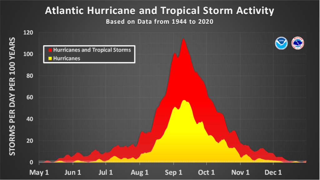
As the Atlantic hurricane season hit its historical peak this week (September 10th), that’s precisely the number of troublesome storms so far: one. Tropical Storm Edouard made a run at becoming the season’s first hurricane but fell short … and yet it still managed to wallop eastern Texas with damaging winds at the coast and flooding rain that triggered flash flood emergencies in and around Lufkin.
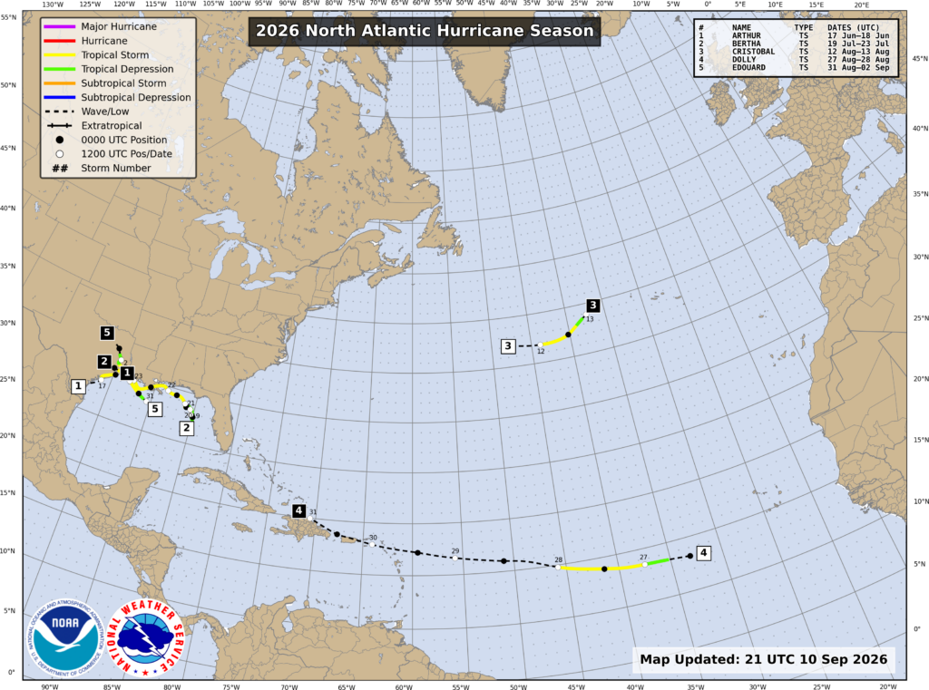
That is what NOAA alludes to: the “one,” even if a “mere” tropical storm like Edouard, that can unleash significant hurricane-related impacts wherever it comes ashore. With Edouard, that was in eastern Texas and southwestern Louisiana. But will Edouard turn out to be the only one this season for the Atlantic?
(One other Gulf Coast tropical storm could be considered the one for those directly impacted this season: Arthur formed in mid-June and made landfall very near where Edouard did in extreme eastern coastal Texas, but was moving northeast instead of northwest. It unleashed its heaviest flooding rainfall of nearly 2.5 feet north and east of landfall in the south-central Louisiana town of Cottonport.)
Now jump across part of the globe and zero in on Hawaii. In most years, Hawaii is quiet as a church mouse for hurricane impacts. But this isn’t most years. This is one of THE years when Hawaii residents—as they recently found out—need to watch out most. An El Niño is intensifying in the tropical Pacific, and it’s forecast to become super-strong. El Niño years are when Hawaii can realize not only threats but actual impacts from tropical storms and hurricanes, which usually are deadly dangerous for the islands.
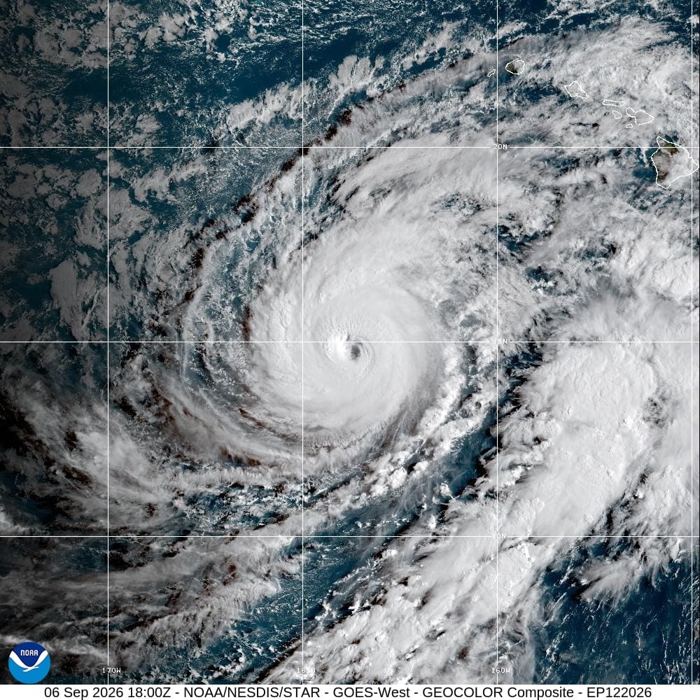
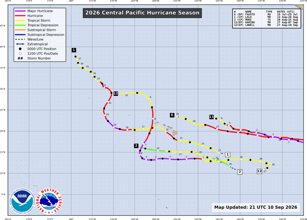
Cue Hurricane Lowell. The once-Category 5 storm made its closest approach to the main Hawaiian Islands overnight Tuesday this week. The westernmost islands of Kauai and especially Niihau bore the brunt of the Category 2 hurricane, with winds in sparsely populated Niihua likely gusting over 100 mph and in Kauai reaching speeds around 90 mph, especially in the higher elevations along the windward and leeward slopes. These winds damaged roofs and windows and toppled thousands of trees that killed power to 90% of Kauai.
In Honolulu and its home on Oahu, tropical storm-force gusts around 50 mph also damaged trees and knocked out power to residents.
Lowell continued its slow weakening midweek while moving northwest of the main Hawaiian islands. But the Papahanaumokuakea Marine National Monument from Nihoa to the French Frigate Shoals that stream west-northwest of the main islands bore the brunt of Lowell’s ferocity with 100 mph winds.
And Lowell wasn’t Hawaii’s only hurricane.
The same region of far western Hawaii weathered the intensity of Category 2 Hurricane Lala just last month. Lala was a too-close-for-comfort near-miss on the Big Island of Hawaii on August 15. And it didn’t matter that its Category 1 core missed: its size and intensity were enough to blow down countless trees, cripple power, and unleash 3 feet of rain that led to deadly flooding and mountain mudslides. As many as three people in Hawaii died from Lala’s onslaught.
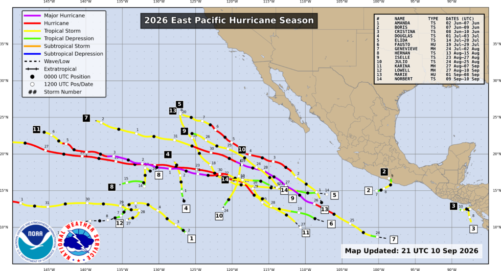
As if Hawaii’s rare encounters with hurricanes this season weren’t enough to raise eyebrows in this unusual Pacific hurricane season, just turn to the flooding surf that pounded coastal Los Angeles over the long Labor Day weekend. Long Beach was particularly hard hit with huge swells from offshore Hurricane Marie, despite its core being some 700 miles away over the open Eastern Pacific. With the supercharged El Niño spreading sweltering sea surface temperatures for the region unusually far north, Marie also maintained wind speeds strong enough to sweep wind-driven waves well north and east into the coastal United States.
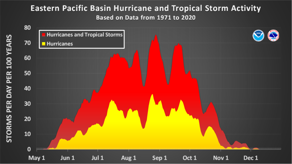
It’s a tale of two juxtaposed hurricane seasons, with one going gangbusters in the Pacific and the other just today, September 11, getting set to pass 2013’s record for the latest first hurricane, Humberto, which matched Gustav’s late formation date in 2002.
And with the Atlantic season only half over, and the Eastern and Central Pacific season showing no signs of slowing down, that caution NOAA concludes with in every seasonal forecast seems quite prescient for all coastal areas subjected to hurricane and tropical storm threats each season. Prepare: Because it only takes one.