Key messages from "The Sundowner Winds Experiment (SWEX) in Santa Barbara, California: Advancing Understanding and Predictability of Downslope Windstorms in Coastal Environments," by Leila M. V. Carvalho (University of California, Santa Barbara), Gert-Jan Duine, Craig Clements, Stephan F. J. De Wekker, Harindra J. S. Fernando, David R. Fitzjarrald, Robert G. Fovell, Charles Jones, Zhien Wang, Loren White, Anthony Bucholtz, Matthew J. Brewer, William Brown, Matt Burkhart, Edward Creegan, Min Deng, Marian de Orla-Barile, David Emmitt, Steve Greco, Terry Hock, James Kasic, Kiera Malarkey, Griffin Modjeski, Steven Oncley, Alison Rockwell, Daisuke Seto, Callum Thompson, and Holger Vömel. Published online in BAMS, March 2024. For the full, citable article, see https://doi.org/10.1175/BAMS-D-22-0171.1.
Santa Barbara, California, is known for its picturesque coastline and mild Mediterranean climate. However, this idyllic landscape is frequently disrupted by devastating wildfires that rapidly spread toward communities, driven by powerful downslope windstorms known as Sundowners. These gusty northerly winds typically intensify after sunset and remain strong through the night. Their synoptic forcing and mesoscale features differ markedly from the Santa Ana winds that typically affect southern California—from Ventura to the Los Angeles Basin—in the fall and winter.
While downslope windstorms occur in other mountainous regions around the world, the narrow east-west-oriented Santa Ynez Mountains (SYM), with elevations exceeding 1,000 m, are unique in several respects. They act as a barrier separating the cool, shallow, and stable marine boundary layer that forms over the Pacific Ocean to the south from the much warmer and drier Santa Ynez Valley to the north. This sharp contrast sets the stage for intense, temporally and spatially variable wind events when synoptic conditions favor cross-mountain winds. Additionally, the SYM increase in elevation from west to east, where they merge with another transverse mountain range—the San Rafael Mountains. The intricate terrain contributes significantly to the timing and intensity of Sundowner winds throughout the evenings.
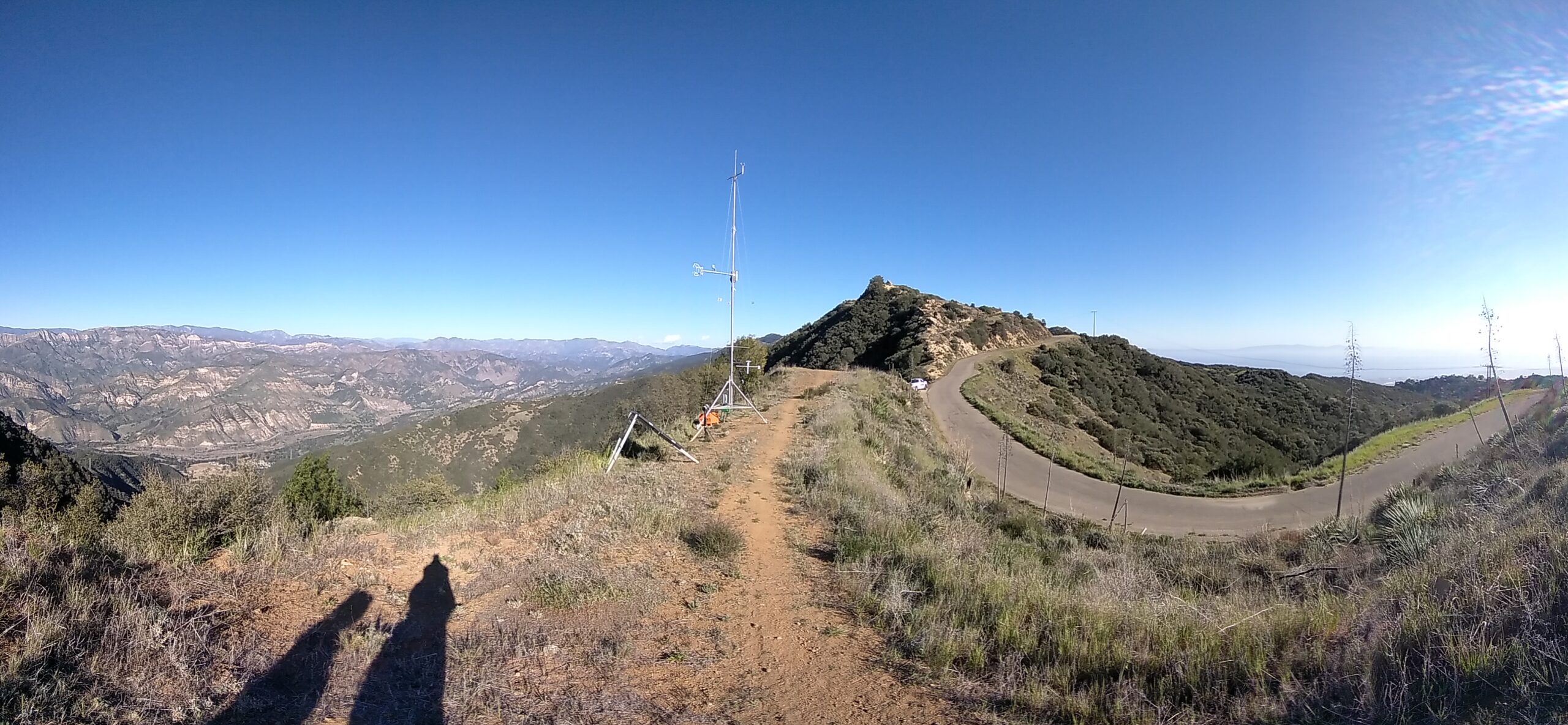
The Sundowner Winds Experiment (SWEX), conducted from April 1 to May 15, 2022, deployed a suite of advanced instruments to collect atmospheric data focused on identifying the physical and dynamical boundary layer processes that lead to windstorms on the southern slopes of the SYM.
The spring of 2022 was particularly active, with Sundowner events occurring on multiple days. SWEX collected wind profiles using airborne LiDARs and dropsondes, ground-based instruments, and a mobile LiDAR. These were complemented by radiosonde launches at multiple sites during 10 active Sundowner events and 3 quiescent periods for comparison.
The campaign also employed innovative techniques, such as collecting vertical profiles of horizontal winds using a Doppler Wind lidar mounted on a mobile ground-based platform—the University of Virginia’s Wind Observatory on Wheels (UWOW). The mobility of UWOW was facilitated by the network of roads, especially the US-101 freeway, which runs along the coast and mirrors the east–west orientation of the SYM. The north–south orientation of some roads also allowed UWOW to capture changes in profiles of winds and the structure of the lee-slope jet. While these roads provided a novel way to observe wind profiles along the slopes, measurements were sometimes limited by tree branches and other obstacles, which were less frequent on the freeway. The UWOW mobility facilitated comparisons between profiles obtained from stationary lidars and wind profilers and, on some occasions, profiles obtained with an airborne Doppler lidar.
One of the most striking findings from UWOW’s multiple profiles was the abrupt transition from very windy to calm conditions over just a few kilometers—an illustration of the sharp spatial variability characteristic of Sundowner wind events. Fixed lidars on mountain slopes and foothills of the SYM also displayed very interesting features, such as the presence of hydraulic jumps with updrafts of about 6 m s–1. They also provided evidence of rotor formation on some occasions in the foothills. While the formation of rotors during Sundowners had been hypothesized, it could only be confirmed through the comprehensive instrument network deployed during SWEX. These rotors are significant for aviation safety and pose challenges during wildfires due to rapid shifts in wind direction.
The instrument network also highlighted the interaction between the continental boundary layer, driven by Sundowners, and the marine boundary layer near the coastal plain. This interaction was often enhanced by atmospheric eddies forming over the Santa Barbara Channel from late evening to early morning. SWEX demonstrated that these interactions are critical to the Sundowner cycle, from the coastal plain to the foothills.
The airborne Compact Raman lidar (CRL) and dropsondes captured temperature and moisture profiles that revealed a highly stratified atmosphere above the mountain tops. CRL also detected high-amplitude mountain waves forming on the lee side of the SYM, often accompanying the intensification of the lee-slope jet. Interestingly, both CRL and dropsonde data showed significant contrasts in wind, temperature, and humidity profiles offshore along the east–west-oriented Santa Barbara Channel. Additionally, profiles across the SYM obtained from these instruments indicated that the lower troposphere is warmer and drier above the stable marine boundary layer south of the SYM, compared to profiles upstream obtained over the Santa Ynez Valley.
By capturing high-resolution observations across multiple platforms, SWEX has significantly advanced our understanding of the boundary layer processes and terrain-induced flows that govern windstorm behavior in coastal mountain regions.
METADATA
BAMS: What would you like readers to learn from this article?
Leila Carvalho (University of California, Santa Barbara): Sundowners, the downslope winds observed on the southern slopes of the Santa Ynez Mountains in Santa Barbara, California, are a fascinating phenomenon because of the unique east–west orientation of the mountains, their narrowness, and their proximity to the cool Pacific Ocean. We highlight how the complex orography of the region creates local features responsible for significant east–west variability in wind speeds, onset time, and the peak of winds. Additionally, observations of mountain waves and relationships with profiles of winds, moisture, and temperature upstream and downstream of the mountains were characterized for the first time. We revealed evidence of hydraulic jumps, their role in the intermittence of the lee-slope jet, and the intriguing “tug of war” between the strong and dry offshore winds and the cool and stratified marine boundary layer.
BAMS: How did you become interested in the topic of this article?
LC: I moved from Brazil to California in 2009 to work as an assistant professor at UC Santa Barbara (UCSB). In May of that year, I witnessed the fury of the Jesusita wildfire, which quickly spread from the eastern slopes of the Santa Ynez Mountains toward downtown Santa Barbara, driven by strong and dry Sundowner winds. That devastating fire disrupted our community, destroyed numerous homes and businesses, and left trauma and pain across the city. The intensity and unpredictability of this Sundowner event made me realize the urgency of better understanding and predicting these winds. The Jesusita Fire was one in Santa Barbara’s long history of destructive wildfires driven by Sundowner winds. Thus, the mix of curiosity and personal involvement with the issues that face our community have inspired most of my career at UCSB.
BAMS: What got you initially interested in meteorology or the related field you are in?
LC: I have always been fascinated by all kinds of natural sciences. As a child, my favorite hobby was observing weather patterns during the day and the stars and planets at night. I had the privilege of seeing dark night skies and wondering about infinity. This is why I was torn between becoming an astrophysicist and a meteorologist. I was born and raised in São Paulo, Brazil, a region influenced by a monsoon system. Thunderstorms, extreme rainfall, and the winds that accompany summer have always evoked my most primitive fears and my need for rational explanations. That is why meteorology captivated me, and I have been in love with the field since college. My focus on Sundowner winds admittedly has roots in my childhood experiences on the beaches of Brazil, when nocturnal mountain winds, howling like a pack of invisible wolves, kept me awake at night. I knew that one day I would unravel their mystery.
BAMS: What surprised you the most about the work you document in this article?
LC: The SWEX campaign revealed many surprising findings—some that confirmed our model-based hypotheses, and others that we had not anticipated at all. One of the most striking discoveries was the large variability in wind regimes across the southern slopes of the Santa Ynez Mountains.
We were particularly amazed by the frequency of Sundowners on the western slopes and how abruptly Sundowners on the eastern slopes would begin and end. It was especially exciting to observe evidence of mountain waves and hydraulic jumps, with upward velocities exceeding 6 meters per second, captured by stationary lidars. These appeared to be associated with the lifting of the lee-slope jet and intense turbulence.
Airborne measurements collected by Raman and Doppler lidars, along with dropsondes deployed from the Twin Otter aircraft, revealed extremely dry layers above the mountain tops. These layers, which are strongly influenced by orographic gravity waves, exhibited estimated specific humidity values below 2 grams per kilogram. This helps explain the sharp drops in humidity often observed during Sundowner events and their potential to create extreme fire weather conditions.
BAMS: What was the biggest challenge you encountered while doing this work?
LC: As always, one of the major challenges during experiments in complex terrain is selecting appropriate sites and installing flux towers and other ground-based instruments on both public and private land. The experience and professionalism of the NCAR/EOL staff were instrumental in overcoming these hurdles.
However, the most difficult aspect was navigating a field campaign that was originally scheduled to begin in April 2020—just two weeks after the Covid-19 pandemic was declared. It was a tough decision: everyone had to return home, leaving behind instruments that had already been deployed. This period was marked by great uncertainty, but it also highlighted the exceptional understanding of NSF program managers and the strong camaraderie among SWEX researchers and NCAR staff.
Since I live in Santa Barbara, I was able to check on the instruments and ensure they remained operational and were not vandalized. This unexpected responsibility gave me a valuable opportunity to learn about instrument maintenance and the upkeep of flux towers and wind profilers—truly a case of making lemonade out of lemons. Although SWEX was delayed by two years, it was successfully carried out in the spring of 2022, during a very active Sundowner season.
BAMS: What’s next? How will you follow up?
LC: Understanding mountain windstorms and improving fire weather forecasts in fire-prone regions present significant opportunities for future research. Our group has been addressing these challenges through both modeling and observational approaches for nearly a decade, and we intend to continue this work in the years ahead. As the planet warms, wildfire risk is expected to increase, posing growing threats to communities and ecosystems. With population growth, it is inevitable that more communities will be established in fire-prone areas. Addressing these challenges will require coordinated, multidisciplinary efforts—among them, the development of more accurate fire weather forecasts with high spatial and temporal resolution. Building on our expertise in mountain windstorms, we aim to advance research that integrates intensive field observations, high-resolution modeling, and machine learning techniques.