Three field campaigns—the Surface Atmosphere Integrated Field Laboratory (SAIL); the Study of Precipitation, the Lower Atmosphere and Surface for Hydrometeorology (SPLASH); and the Sublimation of Snow (SOS) experiment—took place in the mountains of the East River Watershed of the Colorado Rocky Mountains between September 2021 and September 2023. While each field campaign had targeted, campaign-specific goals, the three campaigns shared a common goal of integrating atmospheric and surface observations of water and energy budgets in complex terrain to improve our understanding of the physical processes driving these budgets and, ultimately, their representation in models. Combined, the three field campaigns deployed a wide variety of instruments to make detailed measurements of cloud and precipitation processes; surface properties including snow characteristics, soil temperature, soil moisture, vegetation, and elevation; the surface–air interface including radiative and turbulent fluxes of heat, moisture, and momentum; and lower atmospheric thermodynamic and kinematic properties over the two-year campaign window. The analysis of the data collected from the three campaigns involves multiple research groups across several disciplines (meteorology, cryospheric sciences, hydrology, ecology) and agencies [DOE, NOAA, NSF, Rocky Mountain Biological Laboratory (RMBL)].
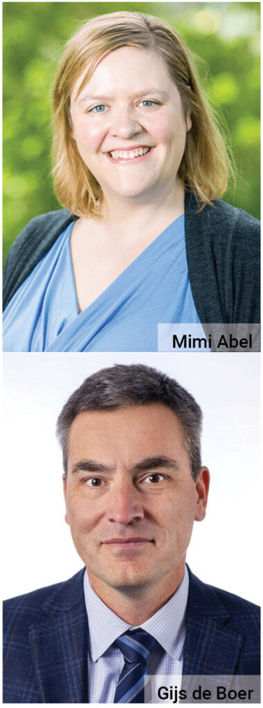
Mimi Abel (NOAA Physical Sciences Laboratory) and Gijs de Boer (Brookhaven National Laboratory), two of the organizers for the Special Collection on Improving Understanding of the Surface–Atmosphere Interface and Hydrometeorology in the Complex Terrain of Western Colorado: SAIL, SPLASH, and SOS, explain the effort to coordinate/collaborate three unique, yet complimentary, field campaigns on a larger than typical scale and lessons learned.
Each of these field campaigns—SAIL, SPLASH, SOS—began as an independent study that took place at the same general time and place. How did the campaigns learn about one another and how did the collaboration among the three come about?
Mimi Abel: My understanding of how the collaboration happened is as follows: SAIL started it all, led by Dan [Feldman (Lawrence Berkeley National Laboratory)]. Gijs was aware of SAIL, and brought the idea of collaboration to NOAA PSL [Physical Sciences Laboratory] leadership. Gijs led some efforts to develop the research plan and scope of SPLASH and get resources through NOAA, with PSL and other parts of OAR [Oceanic and Atmospheric Research] eventually supporting the work. SOS followed—I think it may have been inspired by a lot of discussion about sublimation during one of the early SAIL meetings, and from Jessica’s general interest and knowledge on the subject.
I think in summary it was a little bit of intentional collaboration, particularly by lead PIs Dan, Gijs, and Jessica [Lundquist (University of Washington)], and a little bit of serendipity in securing the complementary resources.
Gijs de Boer: There was definitely quite a bit of “intentional” collaboration. Everything above is correct, but SPLASH was, from the get-go, looking to leverage DOE’s investment in this area through the Watershed SFA [Scientific Focus Area] and the SAIL campaign. SPLASH provided broader regional context by extending the measurements and bringing new tools/resources focused specifically on the water and surface energy budget elements. There is always serendipity when it comes to resources, but I think that there were compelling arguments made as to how/why this would be able to move the needle.
Again, three separate campaigns, all focused in the area of the East River Watershed of the Colorado Rocky Mountains. What is it about this location that makes it a significant area for research?
Mimi: Mountains provide a significant portion of the water resources for the arid western United States. Despite this importance, constraining water availability in this mountainous terrain remains a significant scientific challenge, particularly at fine space and time scales. Because of the challenges in observing surface water and energy budgets in mountains, the sources of errors in our Earth system and numerical weather prediction models have been consistently difficult to untangle from observational uncertainties.
The East River Watershed offered an ideal location to constrain some of these uncertainties for several reasons: its natural complex terrain and role as a headwaters watershed in the Upper Colorado River Basin; its location offered some infrastructure that could uniquely support the instrumentation requirements and science goals such as the Rocky Mountain Biological Laboratory; it’s also the location of the DOE Watershed function Science Focus Area (https://watershed.lbl.gov/).
Either collectively or for any of the campaigns individually, were there unique challenges faced that weren’t anticipated? How were they overcome?
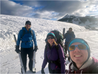
Gijs: There were many challenges associated with siting instrumentation in this area. Access is better than in other parts of the mountains, but still quite limited overall. The Gothic area, while it has lodging, is also in a nonmotorized valley, which means that access in winter was by skis/snowshoes only (including most gear). According to my smart watch, I had a ~6,000 calorie day on one of my trips out there, and several days that exceeded 4,000 calories.
Additionally, one of the two winters was quite epic from a snowfall perspective. This caused challenges with keeping instrumentation clear and working, though we can’t complain since it was the snow that we were there to study!
How has the science and society benefited from the research conducted by the SPLASH, SAIL, and SOS campaigns?
Mimi: Combined, the field campaigns offered answers to several scientific questions, all of which are of benefit to society because of their focus on water in arid mountainous regions. An attempt at a summary:
– Better constraints on how much precipitation reaches the ground in arid mountainous watersheds, how this is represented in high-resolution operational models, and how gap-filling radar can improve our estimates of this important hydroclimate variable
– The most direct observationally constrained estimates of snow water “lost” to sublimation in Colorado, important for understanding how much streamflow will result from a given snowpack
– Identified that state-of-the-art models struggle to represent some important processes in complex terrain, such as widespread cold biases and precipitation errors in regional Earth system models and numerical weather prediction models
– Increased our knowledge of the large- and small-scale controls that dominate the weather that produces Colorado water supply, including better understanding of cloud radiative effects, synoptic weather regimes, and the occurrence of extreme wet spells. Collectively, the studies from the three field campaigns provide observational and climatological foundations for improved weather and seasonal prediction.
Gijs: I agree with all of the above. I think that there was also some interesting work on the evolution of the snowpack albedo over the melt season, and some of the very quick transitions that we saw due to dirt/dust and other material melting out of the snowpack.
Are there next steps planned? Where does the science go from here?
Mimi: Work is still ongoing by the campaign scientists to answer research questions. In addition, the hundreds of TB of data that were collected are freely available and will continue to serve the community for years/decades to come, as an extensive resource for process studies and benchmark datasets to evaluate models.
Gijs: I agree with Mimi that we are still very much in analysis mode. Ultimately, it would be great to have many more people doing the same, and I would strongly encourage the mountain meteorology and hydrology communities to consider how they might use these datasets to answer their own questions!
Submissions to the Special Collection on Improving Understanding of the Surface–Atmosphere Interface and Hydrometeorology in the Complex Terrain of Western Colorado: SAIL, SPLASH, and SOS are currently being accepted. Visit the Call for Papers for more information.