This is the first in a three-part series on tornado season and the storm chasing researchers of the FARM Facility.
It was an almost-perfect storm for the Doppler on Wheels (DOW) team. With seasoned forecasting skills and a little luck, the crew of researchers managed to track a storm developing in Oklahoma and get two truck-mounted Doppler radars positioned in front of a tornado as it touched down on farm fields near the town of Duke on May 23, 2024. As they watched, the tornado intensified to extreme speeds.
“We got the radars out in front, two of them so we can look from different angles at the tornado, and watched the whole evolution process,” said Josh Wurman, founder of the DOW project, who was speaking with AMS Headlines from a rest stop in Iowa during the team’s first field deployment of 2026. “That tornado had winds well over 200 miles an hour, so way into the EF5 range*. It’s the fastest-scanning dual-Doppler observations we’ve ever been able to get in something like that.”
“The view from our vantage was incredible,” Jen Walton, of AMS partner organization Girls Who Chase, wrote later. “We got to watch the tornado morph and get closer and closer. The path it ended up taking, we were able to stay put for more than an hour and have almost 40 minutes of dual-Doppler data scanning every seven seconds, which is incredible.” Walton, a storm chaser, is in her third season working on the DOW team.
To complete the picture, other members of the team raced out to place Pods — weather instrument stations designed to be deployed fast — in the path of the oncoming storm. This went a little less perfectly.
“We sent our teams out to drop Pods and launch weather balloons into the tornado and out ahead of the tornado,” recalled Wurman. “They got stuck in the mud! And then we sent another vehicle to go rescue them, and that vehicle got stuck in the mud.” Those teams had to make what observations they could from a less-than-ideal location.
Such setbacks are all part of doing research in the heart of severe weather, which never lacks real-world obstacles. Part of the team’s expertise lies in avoiding the worst.
“If you get your vehicle in the big hail that can be damaging,” Wurman said. “Or worse, your radar gets broken, you get dents in the radar and antennas. We’ve observed almost 300 tornadoes with the DOWs but only been hit a few times because we’re good at staying out and not getting damaged.”
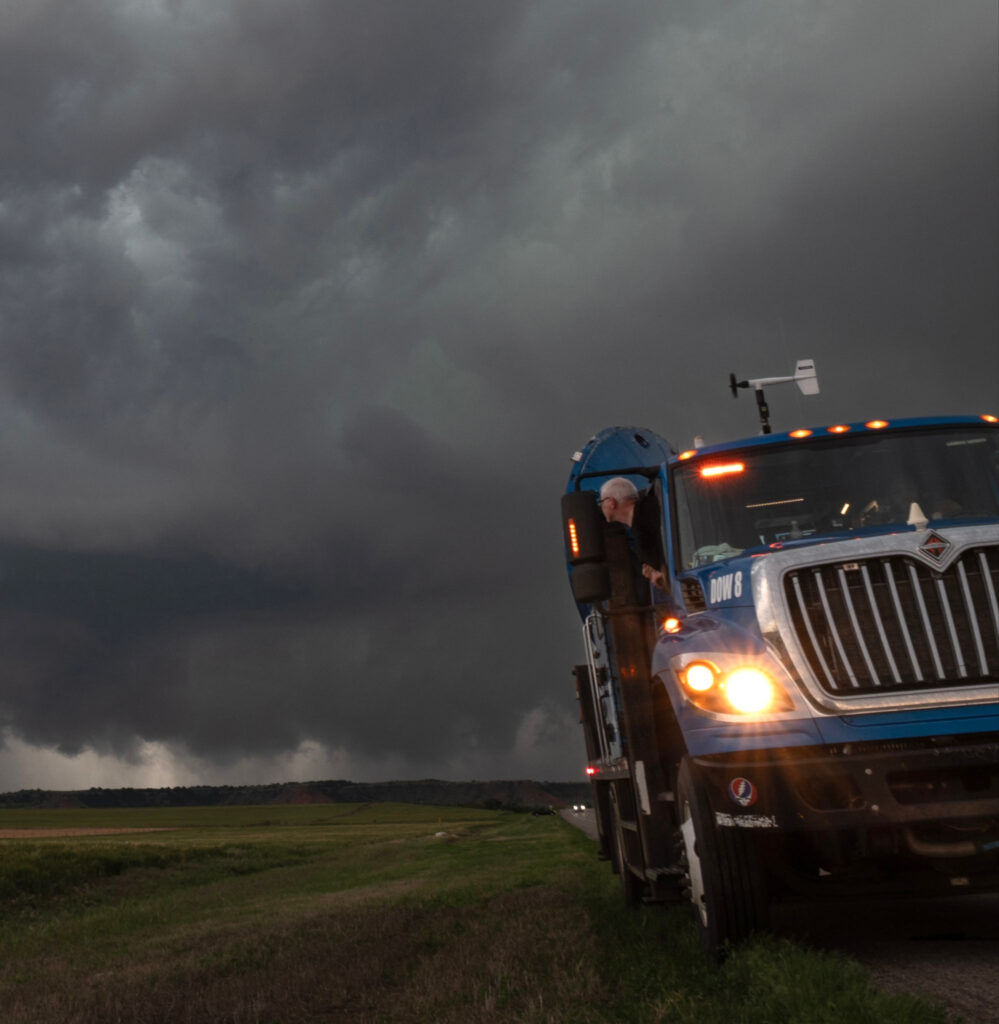
Josh Wurman looks out of the DOW8 vehicle at a supercell in Oklahoma in May 2024. [Photo credit: Jen Walton/FARM Facility]
*Because EF ratings are based on damage surveys rather than actual wind measurements, tornadoes are often given a lower rating than their radar-measured wind speeds would indicate. This tornado mainly struck agricultural land without many structures to damage, so it only received an EF2 rating.
On the Horizon: The 2026 Severe Weather Season
There’s still a great deal we don’t understand about severe storms, partly because of how difficult it is to scientifically observe phenomena like tornadoes. In order to get high-resolution data, you need to be close to a storm wherever it appears — and because of near-surface obstacles and the Earth’s curvature, a radar stationed many miles away can’t get near-ground readings on a tornado at all. Wurman founded the DOW network to acquire data about severe weather that couldn’t easily be obtained from stationary facilities. The DOW vehicles are part of the larger Flexible Array of Radars and Mesonets (FARM) Facility and currently affiliated with the University of Alabama in Huntsville; Wurman is FARM’s executive director.
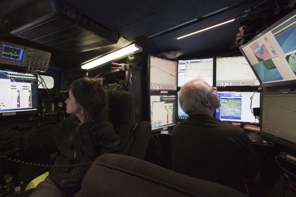
FARM currently operates several quickly deployable truck-based radars: two DOWs, the Rapid-Scan DOW, and the COW (Configurable Radar on Wheels, a longer-wavelength, C-band radar that can penetrate through intense precipitation to see the hail regions inside the supercells), as well as a new C-band “mini-COW” and an array of other instruments. FARM is also working on new systems, including a very small portable radar, bistatic radars, and a fast-spinning GROUNDORA rapid-scan system.
The team chases storm systems hundreds of miles to get an up-close look, hoping to help unravel the secrets of severe weather.
“We’re really looking at how the tornado keeps going — how it keeps getting vorticity or spin to it, and looking at some of the contributing storm-scale processes,” noted DOW team co-lead Karen Kosiba, managing director of the FARM. Facility and research scientist at the University of Alabama in Huntsville. “We’re trying to link things that we’re seeing in the near-tornado environment with what’s actually happening with tornado intensity.”
Lately, their research goals are to learn about what causes tornadoes to intensify or weaken, quantify the winds in the lowest levels of tornadoes (below 100 feet above the ground), and understand the differences among thunderstorms that make large versus small hail.
“There’re a lot of storms out there, a lot of them severe,” Wurman said. “Only a small fraction are making the really bad hail, or really bad tornadoes. So what is it about the environment, what is it about the particular evolution of those storms?”

The team has just undertaken its first deployments of 2026, pursuing storms from Illinois to Iowa, Missouri, and Oklahoma. They have collected data on a few tornadoes, and they hope this season will help them answer some very specific questions.
“We’re trying to observe tornadoes as they’re doing damage so we can compare wind speeds to what happens, to the degrees of damage that occur,” Wurman said. “We’re looking to watch more vigorous tornadoes in the formation and death process so that we can understand how the stronger ones form and how they weaken.”
“We’re looking 30, 40 feet above ground level, to see what’s happening near the surface,” said Kosiba. “Because we see these very intense winds with the radar and sometimes structures are damaged and sometimes not; seeing how winds actually manifest where people live has been a big thrust of what we’re working on.”
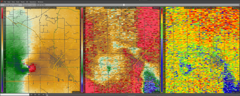
To do this, DOWs and the mini-COW are deployed as close as practical to tornadoes, to create maps of the tornado winds as low as possible, every few seconds.
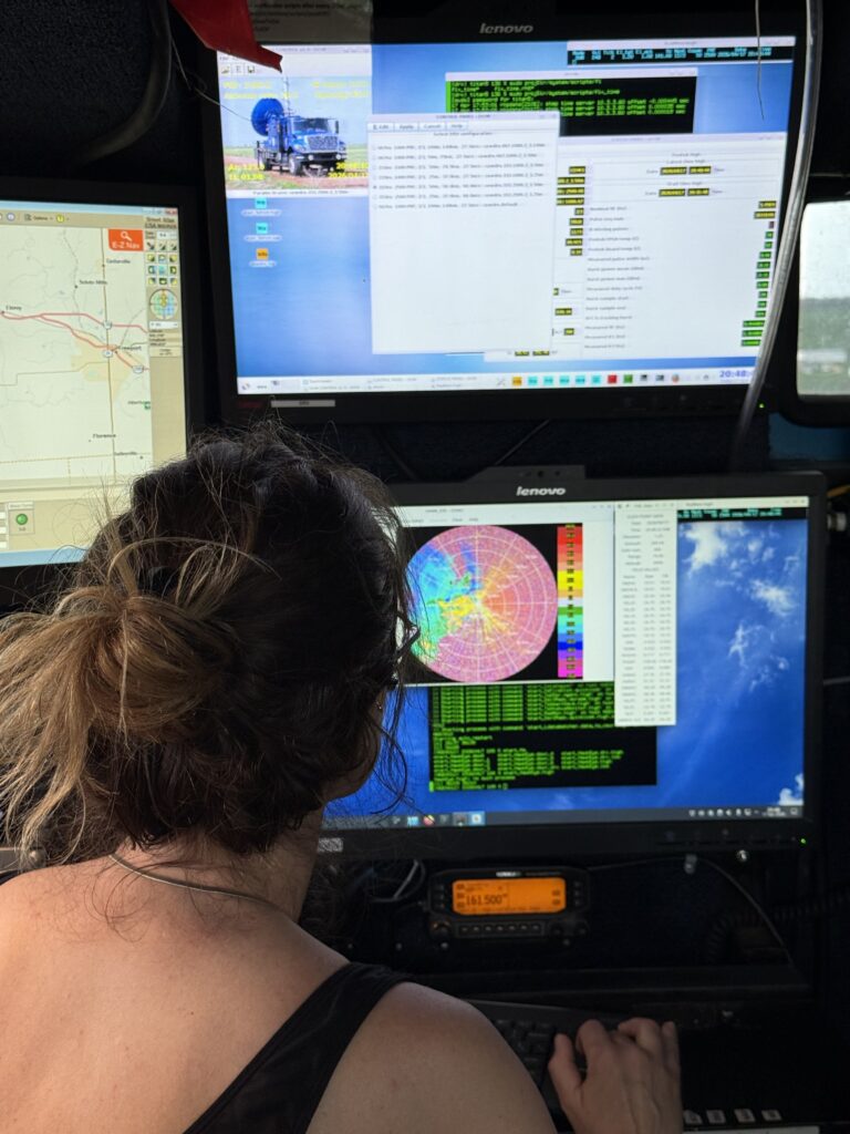
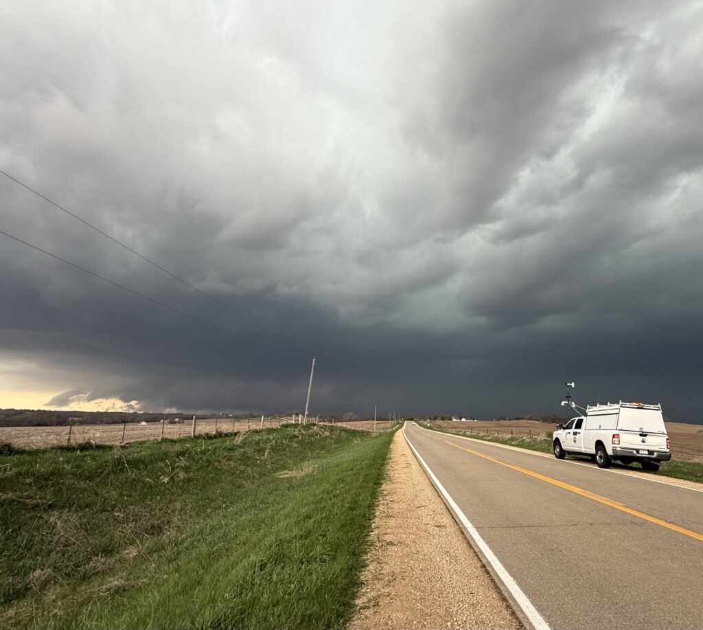
It’s a small team out in the field — about ten people, with two radar trucks, a mesonet truck set up to deploy Pods, and a fourth vehicle deploying Swarmsondes (a type of compact, dual-balloon radiosonde) into the inflow region of storms. The team could join an additional 20 or 30 vehicles, however, when FARM collaborates with other mobile research groups on major projects. Later this year, they plan to coordinate with several other universities to do “more complex choreography” around hail- and tornado-producing supercell thunderstorms.
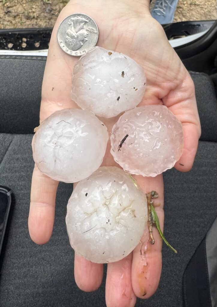
“We will be conducting a joint project, with follow-up seasons for both the hail study ICECHIP, and the Boundary-layer Evolution and Structure of Tornadoes (BEST) project,” noted Wurman. [Read more about BEST in this Headlines post]. “ICECHIP wants to learn more about hail-producing supercells, and BEST wants to learn more about the structure and evolution of tornadoes. Since both hail and tornadoes form in very similar supercells, FARM will deploy a DOW, a mini-COW, 1-2 mesonets, Pods, and some Lagrangian-drifter soundings.” In the late summer and fall they’re on standby for landfalling hurricanes.
When deployed, the team tries to get in the right position, to where a storm is following them, trying to stay just ahead and deploy periodically to make observations. So far in 2026, noted Walton of Girls Who Chase, “it seems like another year — this was happening last year — where the models are making it really difficult to forecast.” Some commentators suggest cuts to National Weather Service observations are a contributing factor, although others disagree. The DOWs are determined to catch the storms regardless.
“When you study severe weather, you go out a lot and you don’t always get what you want,” Kosiba said. “It’s a rare phenomenon, it doesn’t happen that often and you’re not always in the right place.”
“That’s sort of the point,” said Wurman. “Tornadoes aren’t easy to predict, that’s why we’re doing all this.”