Key messages from "The Propagation, Evolution, and Rotation in Linear Storms (PERiLS) Project," by Karen A. Kosiba (University of Illinois Urbana–Champaign), Anthony W. Lyza, Robert J. Trapp, Erik N. Rasmussen, Matthew Parker, Michael I. Biggerstaff, Stephen W. Nesbitt, Christopher C. Weiss, Joshua Wurman, Kevin R. Knupp, Brice Coffer, Vanna C. Chmielewski, Daniel T. Dawson, Eric Bruning, Tyler M. Bell, Michael C. Coniglio, Todd A. Murphy, Michael French, Leanne Blind-Doskocil, Anthony E. Reinhart, Edward Wolff, Morgan E. Schneider, Miranda Silcott, Elizabeth Smith, Joshua Aikins, Melissa Wagner, Paul Robinson, James M. Wilczak, Trevor White, Madeline R. Diedrichsen, David Bodine, Matthew R. Kumjian, Sean M. Waugh, A. Addison Alford, Kim Elmore, Pavlos Kollias, and David D. Turner. Published online in BAMS, October 2024. For the full, citable article, click the link above.
The Propagation, Evolution, and Rotation in Linear Storms (PERiLS) project—a large collaborative effort by researchers supported by the National Science Foundation (NSF) and National Oceanic Atmospheric Association (NOAA)—is focused on improving our understanding of tornado-producing storms in the Southeastern United States. The overarching goal is increasing the skill of tornado and other severe storm forecasts and warnings, resulting in reduced loss of life, injury, and loss of property.
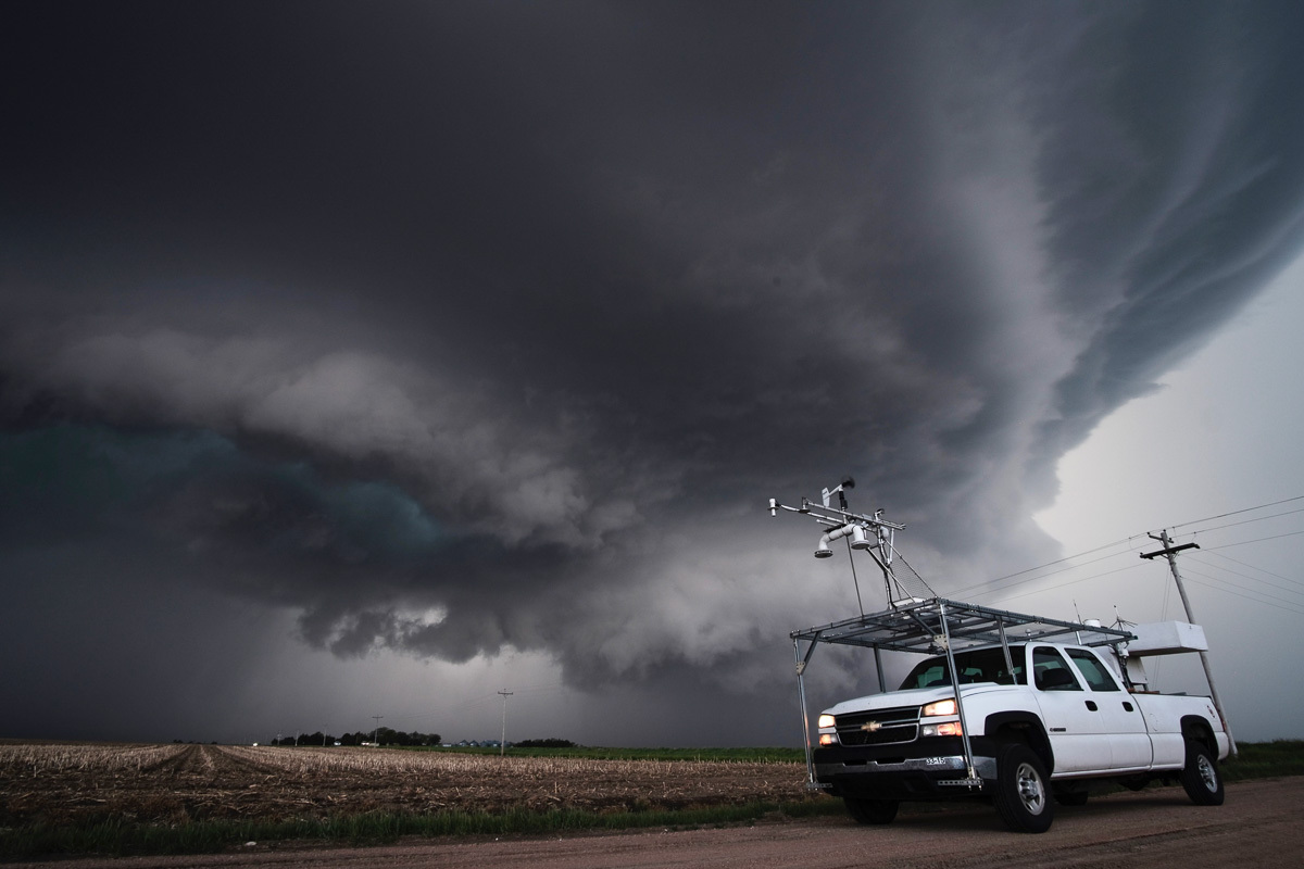
Central to the PERiLS project is the collection of extensive, integrated data in Southeastern tornadic storms. Over 100 scientists and students, from universities and laboratories across the United States, traveled the Southeast, including across Missouri, Arkansas, Louisiana, Tennessee, Mississippi, and Alabama, during the springs of 2022 and 2023, targeting potentially tornadic storms. A huge armada comprising eight mobile/deployable truck-mounted radars, mobile weather stations called mesonets, several dozen deployable instrumented weather stations called pods and sticknets, portable weather balloon launching systems, instrumented quadcopters, a lightning mapping array, profiling systems, and other instrumentation, were deployed.

Since the conclusion of the PERiLS two-year field data collection effort, scientists and their students have been back at their laboratories, busy analyzing these data. Why did some storms make tornadoes, why did a few make strong tornadoes, why did others not make any tornadoes, why did the tornadoes form where they did and not somewhere else, at one particular time and not another, last a long time or exist only briefly? What differences are there between tornadoes, and our ability to forecast and detect these tornadoes, formed by the quasi-linear convective systems (QLCS) associated with many Southeastern tornadoes rather than the Supercells more common in the Great Plains?
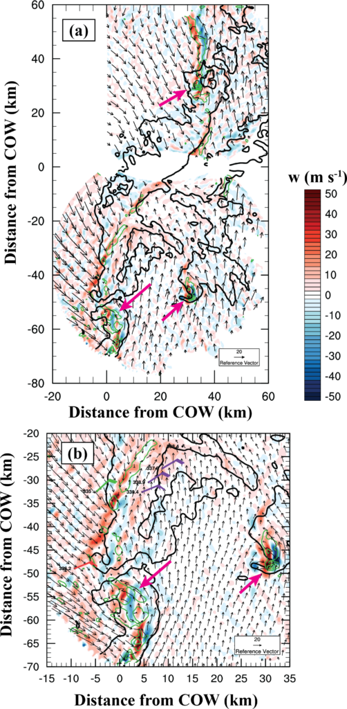
Small differences in the environment feeding these storms are likely some of the key factors. Also, subtle differences in foliage, forestation, land use, hilly terrain, or valleys may affect when and where tornadoes form in the Southeast. A 2025 study led by Matthew Ammon and published in Monthly Weather Review (MWR) examined how terrain may impact the ingredients that contribute to tornado formation, and highlights the importance of boundary layer observations. Once large linear storms form, one of the many challenges forecasters face is predicting where, in these large convective systems, tornadoes will form. Radar data may contain useful clues about which storms may become tornadic, and this can have an immediate operational forecasting and warning skill benefit. According to a recent Weather and Forecasting (WAF) paper by Edward Wolff and colleagues analyzing PERiLS data, identifying localized, strong, deep updrafts may give forecasters advanced warning of where rotation may form. And, strong, narrow, long-lived, small-scale rotations (“mesovortices”) may be precursors to tornado formation, according to another recent WAF paper by Leanne Blind-Doskocil and coauthors.
Since there have been several field studies focusing on Great Plains storms, and comparatively few focusing on storms in the Southeast, researchers are curious about the differences and similarities in the storms occurring in these different geographical locations. PERiLS collected data near the EF-4-rated Rolling Fork, Mississippi, tornado in 2023. Ongoing research led by Anthony Lyza and Josiah Melke, and presented at AMS meetings, is comparing differences between the structure of the parent supercell storm, which produced the tornado that devastated Rolling Fork, to supercell storms occurring in the Great Plains, including increases in instability and wind shear during the hours just prior to tornado formation. It is well known that thunderstorms cause outflows of cool surface air. Details relating to how deep, long in duration, and variable these “cold pools” are may affect which storms produce tornadoes. Using weather balloons and extensive surface weather station observations, Miranda Silcott and her research team in another MWR study examined cold pools in five different PERiLS events and found that, while cold pools were weaker in Southeast storms, they were surprisingly similar to previously-studied Great Plains cases, both in terms of cold pool surface characteristics and vertical profiles (i.e., intensity and depth). Another MWR study, led by Joshua Ostazewski, looked at cold pool properties from all PERiLS cases and how they related to mesovortices. The researchers found strong temperature differences near these rotations and differences in these temperature gradients during the lifetime of the rotations, which may be linked to the likelihood of tornado formation.
Several other studies making use of PERiLS data, led by Vanna Chmielewski presenting her finding at an AMS meeting and Ethan Kerr presenting his as part of a Research Experience for Undergraduates (REU) at the University of Oklahoma, are examining the distribution and frequency of lightning in Southeast severe storms and how that relates to rotation in these storms. The researchers found that certain regions were especially prone to different lightning counts. Lightning frequency may be useful for inferring the intensity of rotation in QLCSs. PERiLS data have also been examined by Bruno Medina and colleagues, and presented at an AGU meeting, to identify the location and frequency of lightning related to low-level effects and the intensity of cold pools, all with the goal of improving the operational/forecasting evaluation of these rotations.
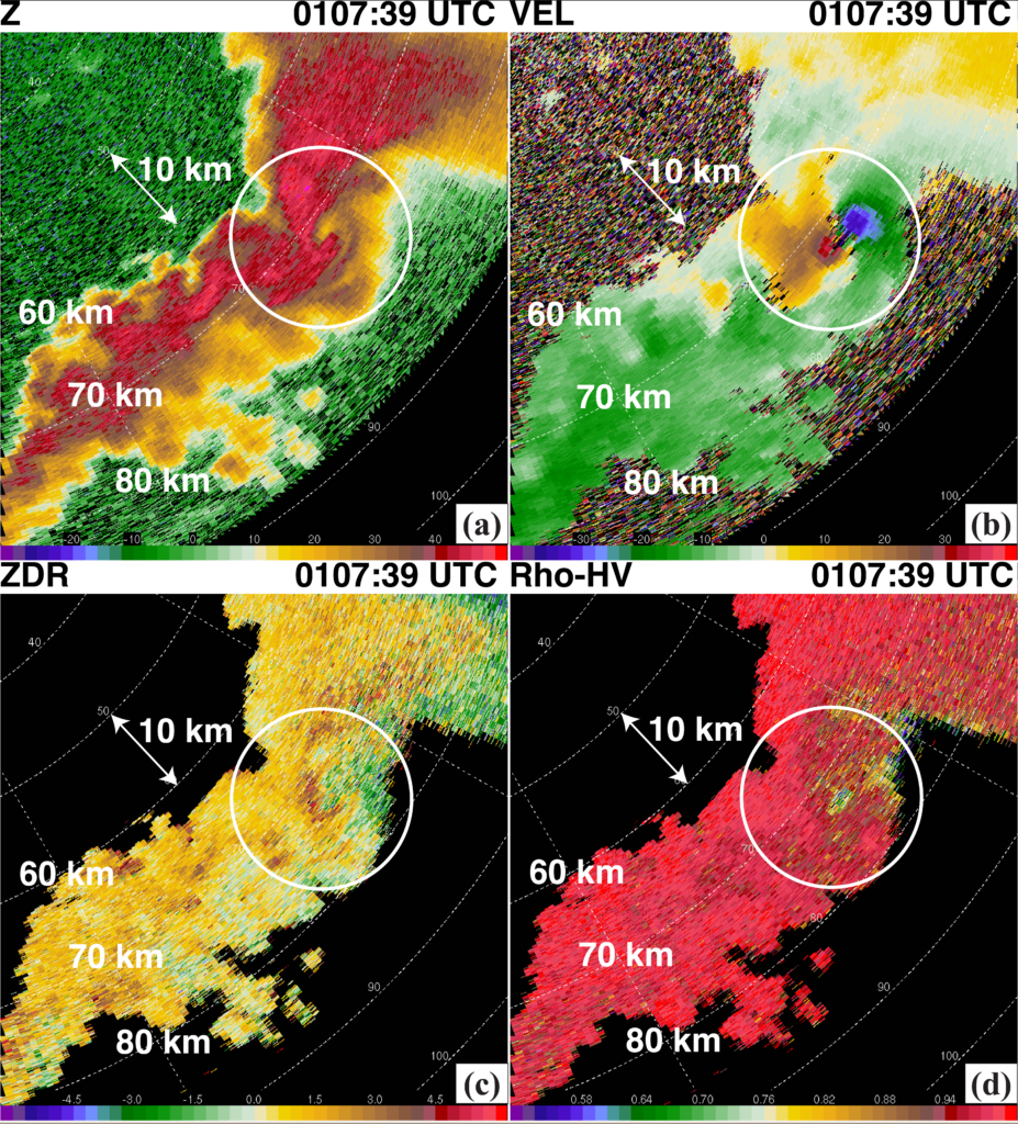
Major strides are already being made in our understanding of Southeastern tornadoes. These many research efforts, by PERiLS scientists across the United States, are expected to continue for several years. Exciting and useful new discoveries are expected, and we hope that these will lead directly to improved forecasts benefiting not only forecasters but people in the direct paths of these hidden and dangerous storms.
METADATA
BAMS: What would you like readers to learn from this article?
Karen Kosiba (University of Illinois Urbana–Champaign): One of the things that I would like readers to gain an understanding of is how field projects work and how they go about answering scientific questions and hypotheses. While there are some similarities, each field project presents its unique challenges. Field projects are years in the making and require a lot of planning before the project even begins! There are specific pressing questions related to actionable outcomes that we seek to answer, and this requires really assessing which instruments are needed and how these instruments need to be deployed in order to get the data we need to start answering these questions. These data are not just available to PERiLS researchers, but to everyone. This article documents the data collected and serves as a resource for future studies. Lastly, I want readers to know about some of the promising early findings and to be on the lookout for more! I am really excited that several of these early studies have identified possible tornado precursors in the PERiLS data, which can really help short-term forecasting of tornado formation.
BAMS: How did you become interested in the topic of this article?
KK: Throughout my career, I have always been interested in how tornadoes form, intensify, and dissipate, and what the winds in tornadoes are like very near the surface, but I have mostly focused on collecting data and studying tornadoes in the Great Plains and in supercell storms. I am not alone in this pursuit; data usually are collected in tornadoes and tornadic storms in the Great Plains because, in part, other areas of the country are much more difficult for data collection due to trees, hills, etc. Over the years, though, it became apparent that tornadic storms and tornadoes need to be studied in different regions of the United States. Storm modes in the Southeast often seem messy, with supercell and quasilinear convective systems (QLCS) co-existing. This presents a unique forecast challenge: in which of these storms or where in the QLCS tornadoes will form. Also, there have been a lot of questions about how terrain might affect the environment feeding these storms and how the terrain might affect the winds in the tornado itself.
BAMS: What got you initially interested in meteorology or the related field you are in?
KK: I was a latecomer to meteorology! I had degrees in physics and teacher education before pursuing an atmospheric science degree. Although I liked nature and engineering, I had never really thought of a career in meteorology. I thought I would be a vet, a patent lawyer, an architect, or a civil engineer . . . not studying tornadoes. When I was working on my physics master’s degree, I worked on laboratory modeling of tornadoes and, even in a laboratory, it was difficult to measure the winds in tornado-like vortices near the surface. I was fascinated with trying to get these measurements and understanding how tornadic winds varied near the surface. After all, this is where we live and these are the winds that impact us. After that, I knew that I wanted to learn more about what impacts the tornado wind structure at the surface, how these winds intensify, how these winds weaken, and how these winds do damage. And I wanted to learn this by collecting data in the field. I was lucky to get opportunities to work with the Doppler on Wheels (DOW) mobile radars and DOW data almost as soon as I began my meteorology career. And, of course, I never stopped! Although I don’t do it much now, I also worked extensively on large eddy simulations (LES) of tornado-like vortices, which has been invaluable for broadening my understanding of these extremely complicated phenomena.
BAMS: What surprised you the most about the work you document in this article?
KK: PERiLS had a large instrument array that was deployed many hours before storms formed. I was surprised to find out that, for the most part, we were in the correct place. This means that we are pretty good at understanding the broad strokes of where the tornadoes will form. But we still need to learn more about precisely where, when, and how strong.
BAMS: What was the biggest challenge you encountered while doing this work?
KK: One of the biggest challenges was trying to optimize the arrangement of multiple mobile radars among a huge array of ground-based, airborne, and balloon systems in the best possible way to answer our scientific questions.
BAMS: What’s next? How will you follow up?
KK: Scientists are busy analyzing data and that is a multiyear process. Results are not instantaneous but rather are the result of a lot of years of work. I hope to see actionable outcomes, which may involve more and/or different operational instrumentation and/or different operational strategies. With increased knowledge comes forecast model improvement, and increased lead time for tornado warnings. I also hope that there will be more data collection, because as we learn more, often we have more questions, and that is how we keep advancing our knowledge and the state of the field.